
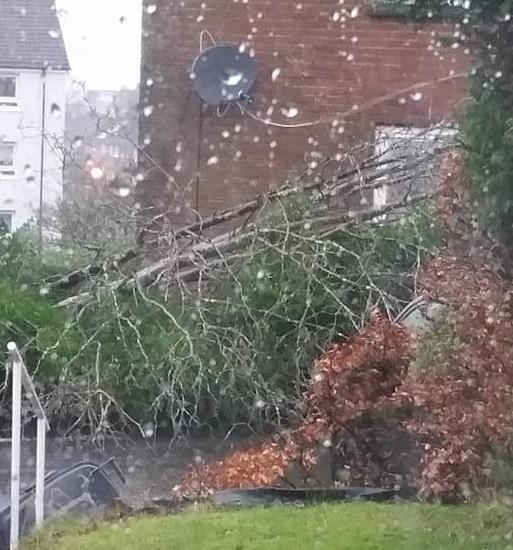

WILD weather is continuing to cause disruption across Renfrewshire after Storm Gertrude roared through the west of Scotland during the night.

Flooding in Lochwinnoch and Paisley are impacting roads and a tree is blocking traffic flow near Bieth with Renfrewshire Council in the process of moving the huge obstruction.
The Erskine Bridge remains closed to high-sided vehicles after having been closed for a period earlier this morning.
Other bridges across the country are also subject to restrictions including the Forth Road Bridge and Tay bridge which are both closed to all traffic.

The Met Office has a severe weather warning still in place, warning the emergency services and the public to be alert to "severe or hazardous weather which has the potential to cause danger to life or widespread disruption".
Many schools in other parts of Scotland have been closed but that's not the case so far Renfrewshire or East Renfrewshire.
Gusts of up to 90mph have been recorded in some parts of the country and major disruption on road and rail networks has been reported.
East Renfrewshire Council (ERC) this morning confirmed that no schools had suffered any damage in the storm.
However, ERC has also said that it is suffering from technical difficulties with its emergency repair hotlines.
A spokeswoman took to Twitter to apologise for the disruption, and added: "Whilst we are experiencing issues with our phones for emergency repairs please contact 07788150234. For all other emergencies - 07887 793791."
Forecast for the next five days
Today:
Heavy rain at first will soon be followed by sunny spells and showers. Very strong west or southwesterly winds with widespread severe gales. Strongest winds will be during the morning rush hour. Showers turning wintry over the hills. Maximum Temperature 7 °C.
Tonight:
A cold night with sleet or snow showers. Some significant accumulations over inland parts of Argyll with drifting over high ground. Staying windy with strong or gale force westerly winds. Minimum Temperature -2 °C.
Saturday:
Feeling bitterly cold with sunny intervals and sleet or snow showers. Further snow accumulations inland, especially high ground of Argyll. Gale force westerly winds, perhaps severe again for a time. Maximum Temperature 5 °C.
Outlook for Sunday to Tuesday:
More settled Sunday with bright spells and wintry showers. Rain later, preceded by snow. Early rain then wintry showers and severe gales Monday. Wintry showers Tuesday but winds easing.
Updates to follow


Comments: Our rules
We want our comments to be a lively and valuable part of our community - a place where readers can debate and engage with the most important local issues. The ability to comment on our stories is a privilege, not a right, however, and that privilege may be withdrawn if it is abused or misused.
Please report any comments that break our rules.
Read the rules hereComments are closed on this article